Atlantic Herring
Atlantic Herring
Clupea harengus

Quick Facts
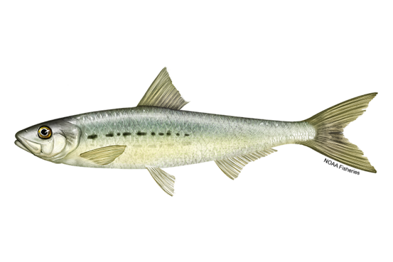
 Atlantic herring. Credit: NOAA Fisheries/Calvin Alexander
Atlantic herring. Credit: NOAA Fisheries/Calvin Alexander
About the Species
U.S. wild-caught Atlantic herring is a smart seafood choice because it is sustainably managed and responsibly harvested under U.S. regulations.

Population
The stock is overfished, but the fishing rate established under a rebuilding plan promotes population growth.

Fishing Rate
Not subject to overfishing.

Habitat Impact
Fishing gears used to harvest Atlantic herring have minimal impacts on habitat.

Bycatch
Regulations are in place to minimize bycatch.
Population Status
- According to the 2022 stock assessment, Atlantic herring is overfished, but not subject to overfishing. Summary stock assessment information can be found on Stock SMART.
- Herring populations are naturally highly variable.
Appearance
- Atlantic herring are small schooling fish.
- They are silvery in color, with a bluish or greenish-blue back.
Biology
- Atlantic herring are one of nearly 200 herring species in the family Clupeidae.
- They grow quickly, up to 14 inches.
- They can live up to 15 years.
- They are able to reproduce when they reach age 4.
- Atlantic herring migrate in schools to areas where they feed, spawn, and spend the winter.
- They spawn as early as August in Nova Scotia and eastern Maine and from October through November in the southern Gulf of Maine, Georges Bank, and Nantucket Shoals.
- Female herring can produce 30,000 to 200,000 eggs.
- They deposit their eggs on rock, gravel, or sand ocean bottom.
- Schools of herring can produce so many eggs that they cover the ocean bottom in a dense carpet of eggs several centimeters thick.
- The eggs usually hatch in 7 to 10 days, depending on temperature.
- By late spring, larvae grow into juvenile herring, which form large schools in coastal waters during the summer.
- Atlantic herring is an important species in the food web of the northwest Atlantic Ocean.
- A variety of bottom-dwelling fish—including winter flounder, cod, haddock, and red hake—feed on herring eggs.
- Juvenile herring are heavily preyed upon due to their abundance and small size. A number of fish, sharks, skates, marine mammals, and seabirds prey on herring.
- Atlantic herring feed on zooplankton (tiny floating animals), krill, and fish larvae.
Where They Live
Range
- Atlantic herring are found on both sides of the North Atlantic. In the western North Atlantic, they are found from Labrador to Cape Hatteras, North Carolina.
Habitat
- Atlantic herring are found in coastal and continental shelf waters.
Fishery Management
- The Atlantic States Marine Fisheries Commission coordinates management of the herring fishery in state waters, and the New England Fishery Management Council manages the fishery in federal waters. The two entities develop their regulations in close coordination. Individual states are responsible for implementing regulations recommended by the Atlantic States Marine Fisheries Commission, and NOAA Fisheries is responsible for implementing regulations recommended by the New England Fishery Management Council.
- Managed under the Atlantic Herring Fishery Management Plan and Interstate Fishery Management Plan for Atlantic Herring:
- Managed using an annual catch limit for the entire herring fishery that is based upon scientific information on the status of the stock.
- The annual catch limit is divided into four area-specific sub-annual catch limits. When an area-specific limit is reached, the directed fishery in that area is closed and only incidental catches of herring are allowed.
- A limited access permit program limits the number of vessels that can participate in the directed fishery for herring. Vessels that do not qualify for a limited access permit can be issued an open access permit, allowing them to harvest a small amount of herring (6,600 pounds) per day or per trip.
- Managers limit the amount of herring a vessel can possess in one day or on one trip, depending on the type of permit it holds.
- The Interstate Fishery Management Plan for Atlantic Herring contains measures that close areas to herring fishing when herring are spawning.
- A rebuilding plan to rebuild the stock to the target population level is in place with a target date of 2026.
Harvest
- Commercial fishery:
- In 2023, commercial landings of Atlantic herring totaled approximately 21.6 million pounds and were valued at $7.7 million, according to the NOAA Fisheries commercial fishing landings database.
- During the past decade, the United States has accounted for 78 percent of the total herring harvest, with Canada harvesting the remainder.
- The Atlantic herring fishery is extremely valuable to the economy in the Northeast United States. Herring are sold frozen, salted, or canned as sardines in both U.S. and international markets and provide affordable bait to fishermen targeting lobster, blue crab, and tuna.
- Gear types, habitat impacts, and bycatch:
- Historically, Gulf of Maine herring were harvested along the coast in fixed-gear weirs (a fence of long stakes driven into the ground with nets arranged in a circle). Today, herring are primarily harvested by mid-water trawlers and purse seiners.
- Mid-water trawlers deploy and tow a net in the water column to catch schooling fish such as herring. The large front end of the net herds schooling fish toward the narrow back end, where they become trapped.
- Purse seiners catch schooling fish near the surface by encircling them with a net. When the net is around the school, fishermen lift up a wire that runs through the bottom of the net, closing the “purse” from below.
- Fisheries that harvest groundfish (such as cod and haddock) and herring operate in the same areas during the same seasons. Herring vessels may incidentally catch groundfish (mainly haddock). Managers set a cap on the amount of haddock that can be caught by the herring midwater trawl fishery.
- The Atlantic herring fishery can incidentally catch marine mammals. Currently, these takes are below limits that would require mitigation under the Marine Mammal Protection Act.
- Management measures to reduce marine mammal interactions include research, outreach to educate fisherman about actions they can take in the event of a marine mammal interaction, and efforts to communicate interaction hotspots to fishermen.
- In 2023, recreational anglers landed 462,000 pounds of Atlantic herring, according to the NOAA Fisheries recreational fishing landings database.
Scientific Classification
- Atlantic herring are found on both sides of the North Atlantic. In the western North Atlantic, they are found from Labrador to Cape Hatteras, North Carolina.
- Atlantic herring are found in coastal and continental shelf waters.
Fishery Management
- The Atlantic States Marine Fisheries Commission coordinates management of the herring fishery in state waters, and the New England Fishery Management Council manages the fishery in federal waters. The two entities develop their regulations in close coordination. Individual states are responsible for implementing regulations recommended by the Atlantic States Marine Fisheries Commission, and NOAA Fisheries is responsible for implementing regulations recommended by the New England Fishery Management Council.
- Managed under the Atlantic Herring Fishery Management Plan and Interstate Fishery Management Plan for Atlantic Herring:
- Managed using an annual catch limit for the entire herring fishery that is based upon scientific information on the status of the stock.
- The annual catch limit is divided into four area-specific sub-annual catch limits. When an area-specific limit is reached, the directed fishery in that area is closed and only incidental catches of herring are allowed.
- A limited access permit program limits the number of vessels that can participate in the directed fishery for herring. Vessels that do not qualify for a limited access permit can be issued an open access permit, allowing them to harvest a small amount of herring (6,600 pounds) per day or per trip.
- Managers limit the amount of herring a vessel can possess in one day or on one trip, depending on the type of permit it holds.
- The Interstate Fishery Management Plan for Atlantic Herring contains measures that close areas to herring fishing when herring are spawning.
- A rebuilding plan to rebuild the stock to the target population level is in place with a target date of 2026.
Harvest
- Commercial fishery:
- In 2023, commercial landings of Atlantic herring totaled approximately 21.6 million pounds and were valued at $7.7 million, according to the NOAA Fisheries commercial fishing landings database.
- During the past decade, the United States has accounted for 78 percent of the total herring harvest, with Canada harvesting the remainder.
- The Atlantic herring fishery is extremely valuable to the economy in the Northeast United States. Herring are sold frozen, salted, or canned as sardines in both U.S. and international markets and provide affordable bait to fishermen targeting lobster, blue crab, and tuna.
- Gear types, habitat impacts, and bycatch:
- Historically, Gulf of Maine herring were harvested along the coast in fixed-gear weirs (a fence of long stakes driven into the ground with nets arranged in a circle). Today, herring are primarily harvested by mid-water trawlers and purse seiners.
- Mid-water trawlers deploy and tow a net in the water column to catch schooling fish such as herring. The large front end of the net herds schooling fish toward the narrow back end, where they become trapped.
- Purse seiners catch schooling fish near the surface by encircling them with a net. When the net is around the school, fishermen lift up a wire that runs through the bottom of the net, closing the “purse” from below.
- Fisheries that harvest groundfish (such as cod and haddock) and herring operate in the same areas during the same seasons. Herring vessels may incidentally catch groundfish (mainly haddock). Managers set a cap on the amount of haddock that can be caught by the herring midwater trawl fishery.
- The Atlantic herring fishery can incidentally catch marine mammals. Currently, these takes are below limits that would require mitigation under the Marine Mammal Protection Act.
- Management measures to reduce marine mammal interactions include research, outreach to educate fisherman about actions they can take in the event of a marine mammal interaction, and efforts to communicate interaction hotspots to fishermen.
- In 2023, recreational anglers landed 462,000 pounds of Atlantic herring, according to the NOAA Fisheries recreational fishing landings database.
Scientific Classification
| Kingdom | Animalia | Phylum | Chordata | Class | Actinopterygii | Order | Clupeiformes | Family | Clupeidae | Genus | Clupea | Species | harengus |
|---|
Featured News
 Juvenile coho salmon. Credit: iStock
NOAA Fisheries Releases 2023 Status of Stocks

River Herring Science in Support of Species Conservation and Ecosystem Restoration
 Winter flounder (Pseudopleuronectes americanus) in Narragansett Bay. It is a flatfish native to coastal waters of the western North Atlantic coast from Labrador to Georgia, although it is less common south of Delaware Bay. It feeds on bottom-dwelling animals. Photo: NOAA Fisheries
Predator-Prey Interaction Study Reveals More Food Does Not Always Mean More Consumption

Related Species

Seafood Facts

Is Atlantic Herring Sustainable?
U.S. wild-caught Atlantic herring is a smart seafood choice because it is sustainably managed and responsibly harvested under U.S. regulations.
Availability
Year-round. Most of the herring eaten in the United States is canned and either pickled or smoked.
Source
U.S. wild-caught from Maine to North Carolina.
Taste
Small fresh herring have a more delicate flavor, while larger herring have a fuller, oilier flavor.
Texture
The meat of fresh herring is soft.
Color
The meat of fresh herring is off-white.
Health Benefits
Atlantic herring are a great source of omega-3s, vitamin B12, and iron.
Nutrition Facts
Servings: 1; Serving Weight: 100 g (raw) ; Calories: 158; Protein: 17.96 g ; Total Fat: 9.04 g; Total Saturated Fatty Acids: 2.04 g; Carbohydrate: 0 g; Total Sugars: 0 g; Total Dietary Fiber: 0 g; Cholesterol: 60 mg; Selenium: 36.5 mcg; Sodium: 90 mgSustainable Seafood Recipes
Looking for a new seafood recipe or an old favorite? If you need some cooking inspiration, browse these seafood recipes for main dishes, appetizers, sides, and more!

Seafood News
 Fresh-caught taʻape on ice. Credit: Conservation International Hawaiʻi.
Reducing Waste and Feeding Communities in Hawaiʻi with a Whole Fish Approach
 Chef Tyler Hadfield’s Curried Skate Wings with Tomato-Masala Chutney
Ring In the New Year With These Crowd-Favorite Seafood Recipes
 NOAA Fisheries, in collaboration with Blue Ocean Mariculture, is conducting a multi-year pilot study to evaluate observational methods and tools for studying Hawaiian monk seal behavior. Courtesy of Blue Ocean Mariculture
AI Meets Aquaculture to Study Hawaiian Monk Seal Interactions With Net Pens
 Tonya Wick aboard a fishing vessel at sea in 1998. Photo courtesy of Tonya Wick
Exempted Fishing
The Northeast Multispecies (Groundfish) Fishery Management Plan prohibits fishing with small-mesh bottom trawl gear, except in specific exemption areas. These exemption areas are summarized here. For additional information about the specific requirements for each area, including possession limit and gear requirements, please visit the area-specific webpages linked within the tables below.
A Letter of Authorization (LOA) is required to fish participate in some of these exemption areas. You can apply for a Letter of Authorization through your Fish Online account. If you need help with the online application or setting up an account, or have any other questions about the online forms and applications, please contact our Permits Office at (978) 282‐8438 between 8 a.m. and 4:30 p.m. ET or email NMFS.GAR.Permits@noaa.gov.
Gulf of Maine and Georges Bank Small-Mesh Exemption Areas
Atlantic herring may be retained by vessels fishing with small-mesh bottom trawl gear in the exemption areas listed in the table below, provided vessels meet the following criteria:
- Comply with all applicable season, area, and gear requirements.
- Comply with all applicable possession limits.
- Are issued a whiting (Category K Open Access Northeast Multispecies) permit or a limited access Northeast multispecies permit.
Herring is considered an incidentally-caught species in these exemption areas; therefore, in order to fish with small-mesh bottom trawl in these areas, vessels must be on a trip targeting whiting
| Area Name | Season | LOA Required? | River Herring/Shad Retention Allowed? |
|---|---|---|---|
| Gulf of Maine Grate Raised Footrope Trawl Whiting Fishery Exemption Area | July 1 – November 30 | No | Yes (alewife only) |
| Cultivator Shoal Whiting Fishery Exemption Area | June 15 – October 31 | Yes | No |
| Small-Mesh Exemption Areas 1 & 2 | Small-Mesh Area 1: July 15 – November 15 Small-Mesh Area 2: January 1 – June 30 | No | No |
| Raised Footrope Trawl Exempted Whiting Fishery Areas (Cape Cod) | September 1 – November 20 September 1 – December 31 | Yes | No |

Southern New England Exemption Area
Vessels may fish with small-mesh bottom trawl gear on herring trips in the Southern New England Exemption Area, provided they comply with all applicable gear and possession requirements.
| Area Name | Season | LOA Required? | River Herring/Shad Retention Allowed? |
|---|---|---|---|
| Southern New England Exemption Area | Year-round | No | Yes (alewife, blueback herring, American shad, hickory shad) |

Mid-Atlantic Regulated Mesh Area
Vessels may fish with small-mesh bottom trawl gear on herring trips in the Mid-Atlantic Regulated Mesh Area, provided they comply with all applicable gear and possession requirements.
| Area Name | Season | LOA Required? |
| Mid-Atlantic Regulated Mesh Area | Year-round | No |

Science Overview
NOAA Fisheries conducts various research activities on the biology, behavior, and population health of Atlantic herring. The results of this research are used to inform management decisions for this species.
For detailed information about stock status, management, assessments, and resource trends, you can search for Atlantic herring, and any other species of interest, using NOAA’s StockSMART web tool.
Atlantic Herring Research in the Northeast
Scientists at the Northeast Fisheries Science Center collect data on herring through bottom trawl surveys as well as a dedicated herring acoustic survey, concentrated on the Georges Bank region. Private research institutions, the science center, and members of the lobster fishing industry—who have an interest in the herring resource as a bait source—have conducted acoustic herring surveys since 1998 using smaller industry vessels. Their sampling is largely concentrated on inshore Gulf of Maine herring stocks.
Stock Assessment Review Index
Fishery Stock Assessments in New England and the Mid-Atlantic provides general information about stock assessments, and the Stock Assessment Review Index contains copies of completed assessment documents.
